Historic Maps Of NewJersey
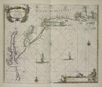 1672 - Pas caerte van Nieu Nederlandt en de Engelsche Virginies van Cabo Cod tot Cabo Canrick. From The New York Public Library Digital Collections |
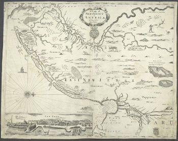 1676 - mapp of New Jersey in America. From The New York Public Library Digital Collections |
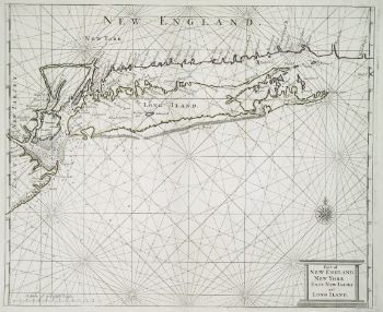 1685 - Part of New England, New York, East New Jarsey and Long Iland From The New York Public Library Digital Collections |
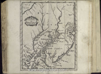 1700 - A new map of New Jarsey and Pensilvania From The New York Public Library Digital Collections |
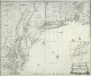
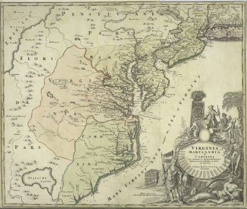 1714-1730 - Virginia Marylandia et Carolina in America septentrionali Britannorum industria excultae From The New York Public Library Digital Collections |
|
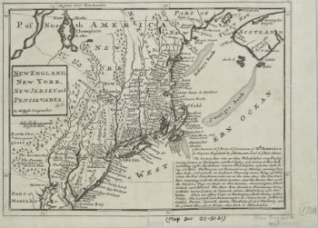 1732 - New England New York New Jersey and Pensilvania From The New York Public Library Digital Collections |
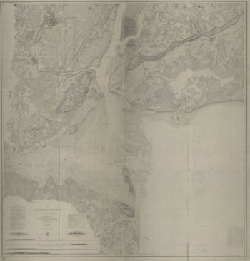
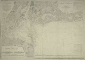
 1733 - New York and Perthamboy Harbours From The New York Public Library Digital Collections |
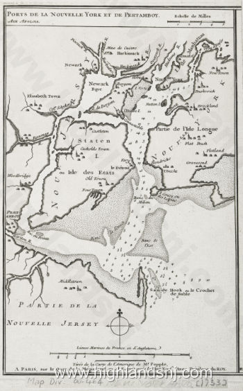 1733 - Ports de la Nouvelle York et Pertamboy From The New York Public Library Digital Collections |
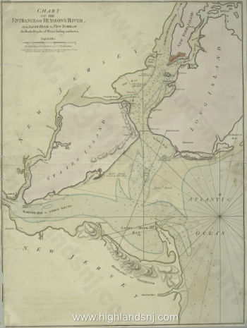 1776 - Chart of the entrance of Hudsons River from Sandy Hook to New York From The New York Public Library Digital Collections |
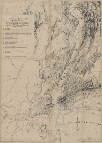 1776 - Sketch of the operations of His Majesty's fleet and army From The New York Public Library Digital Collections |
 1776/08/27 - The seat of action between the British and American forces From The New York Public Library Digital Collections |
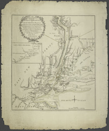
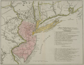
 1777 - Map of the provinces of New-York and New Jersey From The New York Public Library Digital Collections |
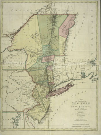
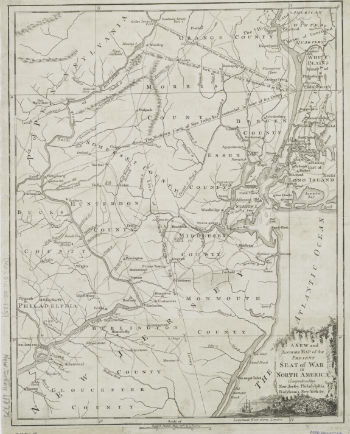 1777 - New and accurate map of the present seat of war in North America From The New York Public Library Digital Collections |
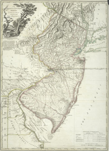
 1777 - The Province of New Jersey divided into East and West commonly called the Jerseys From The New York Public Library Digital Collections |
 1778 - The Province of New Jersey divided into East and West commonly called the Jerseys From The New York Public Library Digital Collections |
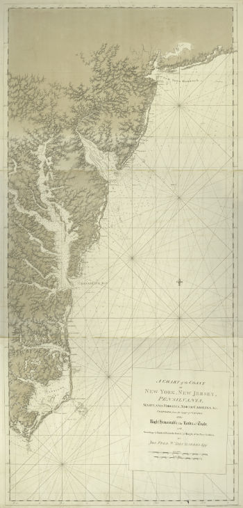 1780 - A chart of the coast of New York, New Jersey, Pensilvania, Maryland, Virginia and North Carolina. From The New York Public Library Digital Collections |
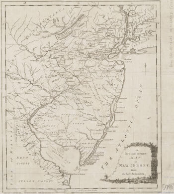 1780 - A New and accurate map of New Jersey. From The New York Public Library Digital Collections |
 1780 - New York und dem Jerseys in Nord America. From The New York Public Library Digital Collections |
 1781 - New York und dem Jerseys in Nord America. From The New York Public Library Digital Collections |
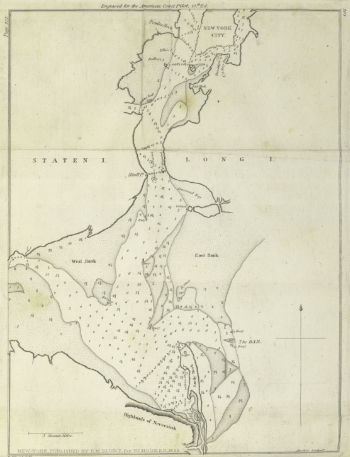
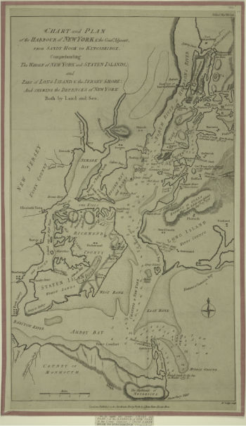 1781 - plan of the harbour of New York & the Couny. From The New York Public Library Digital Collections |
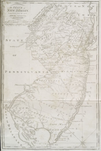
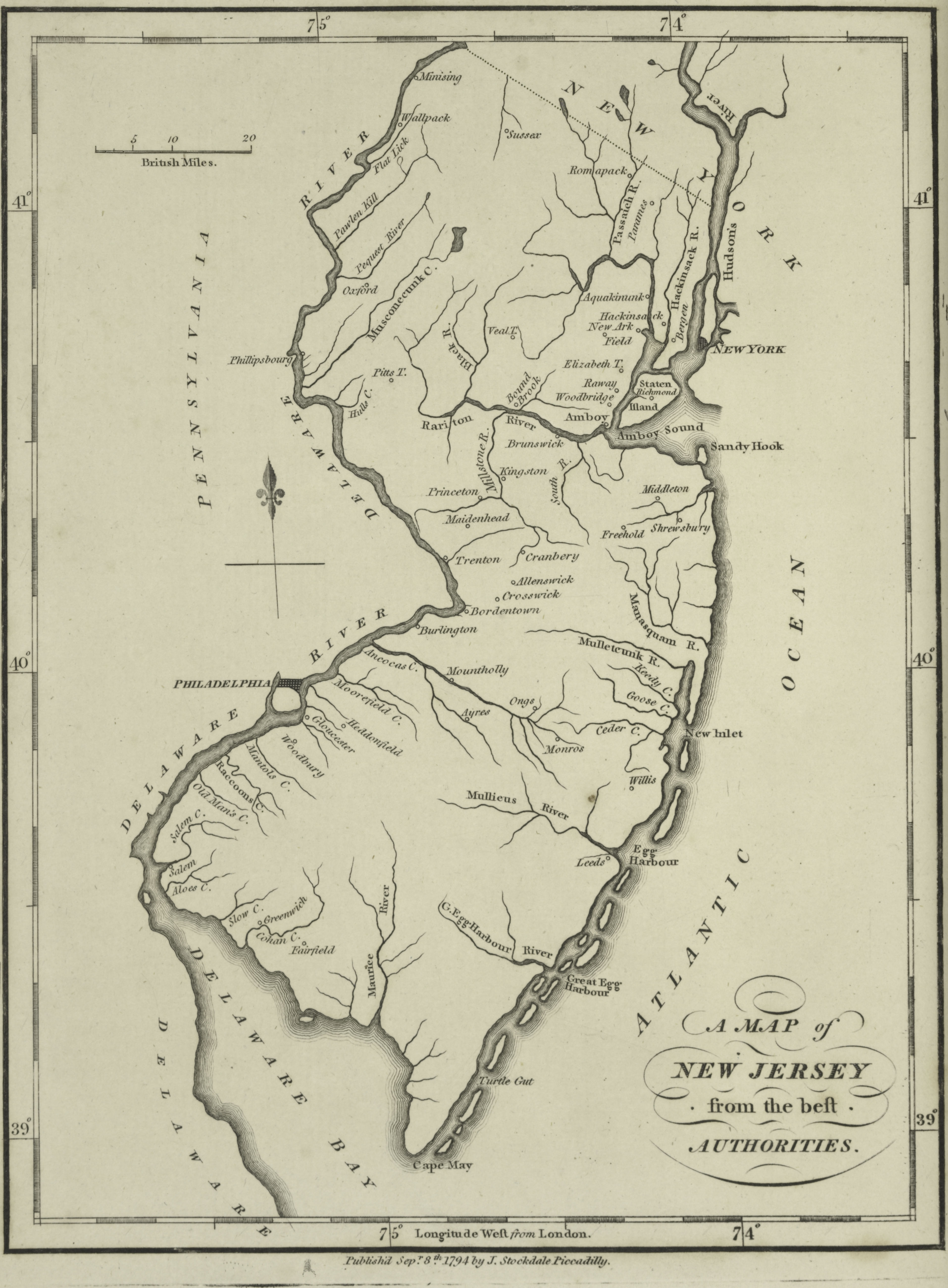 1794 - map of New Jersey from the best authorities. From The New York Public Library Digital Collections |
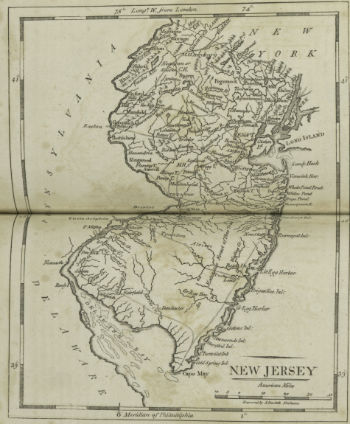 1801 - map of New Jersey. From The New York Public Library Digital Collections |
 1804-1809 - Map of the state of New Jersey compiled from the most authentic information. From The New York Public Library Digital Collections |
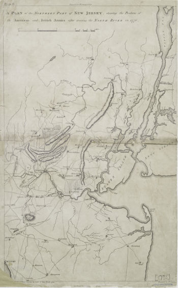 1807 - 1807 plan of the northern part of New Jersey. From The New York Public Library Digital Collections |
 1822 - Entrance to New York Bay from Sandy Hook. From The New York Public Library Digital Collections |
|
|
|
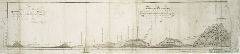 1819 - Geological section of the country from the neighborhood of Sandy Hook in New Jersey northward through the Highlands in New York towards the Catskill Mountains. From The New York Public Library Digital Collections |
|
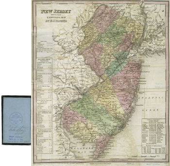 1834 - New Jersey. From The New York Public Library Digital Collections |
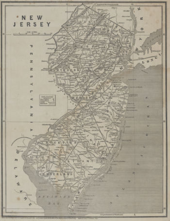 1842 - New Jersey. From The New York Public Library Digital Collections |
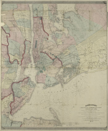
 1844 - Map of New-York Bay and Harbor and the environs. From The New York Public Library Digital Collections |
 1845 - Map of New-York Bay & Harbor and the environs - colored additions to show positions of troops & fleets - Battle of Long Island 1776. From The New York Public Library Digital Collections |
 1864 - Map of New-York Bay and Harbor and the environs. From The New York Public Library Digital Collections |
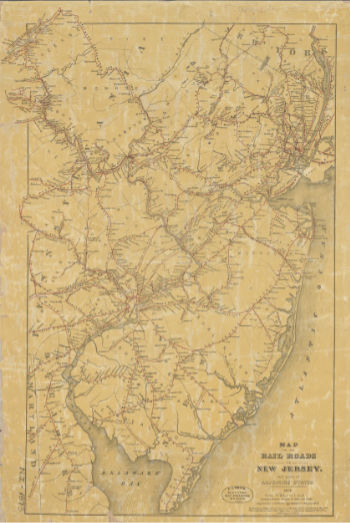 1873 - Map of the rail roads of New Jersey. From The New York Public Library Digital Collections |
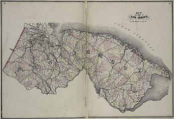
 1873 - Portions of Middletown and Ocean Townships. From The New York Public Library Digital Collections |
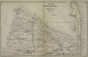
 1874 - Portions of Middletown and Ocean Townships. From The New York Public Library Digital Collections |
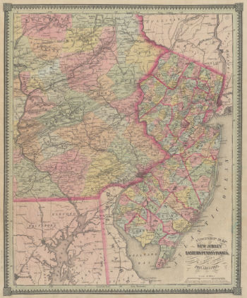
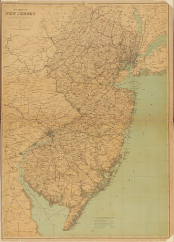
 1877 - Map of State of New Jersey. From The New York Public Library Digital Collections |
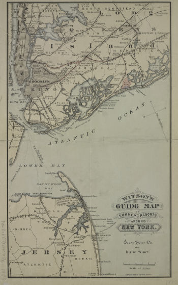 1880 - Watson's guide map to summer resorts around New York. From The New York Public Library Digital Collections |
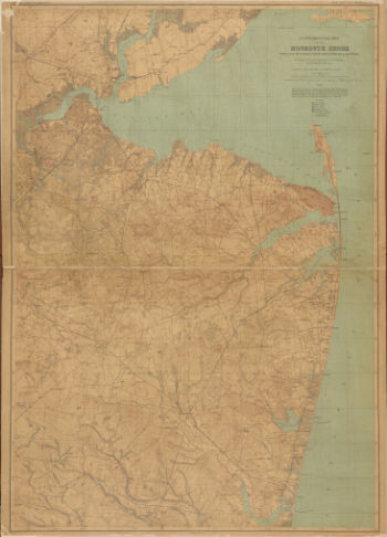 1886 - New Jersey, Double Page Sheet No. 9 Map of Monmouth Shore. From The New York Public Library Digital Collections |
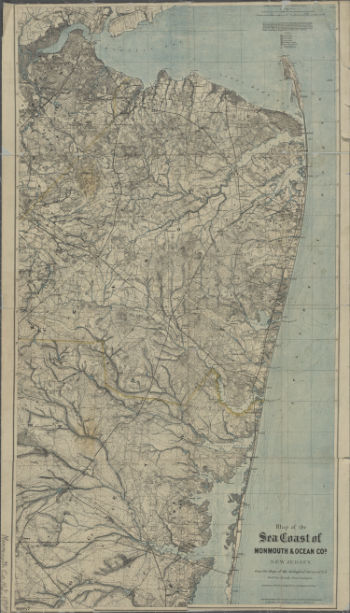 1887 - Map of the Sea Coast of Monmouth & Ocean Co.s, New Jersey. From The New York Public Library Digital Collections |
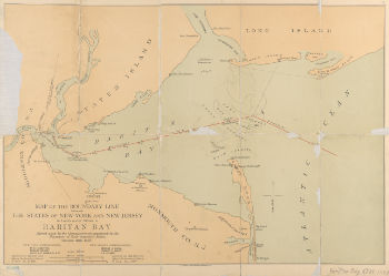 1887 - 1887 Map of Raritan Bay NJ. From The New York Public Library Digital Collections |
 1888 - Map of New Jersey Double Page Sheet No 18. From The New York Public Library Digital Collections |
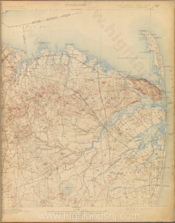
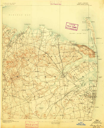 1888 - USGS NJ Sandy Hook From USGS Store |
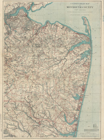 1889 - Coltons road map of Monmouth County From The New York Public Library Digital Collections |
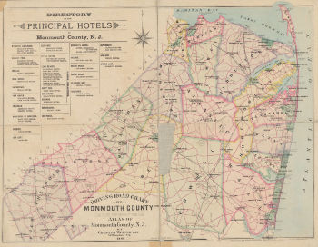 1889 - Driving road chart of Monmouth County Principal Hotels From The New York Public Library Digital Collections |
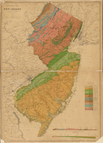 1889 - Geological map of New Jersey, Double Page Sheet No 20 From The New York Public Library Digital Collections |
 1901- USGS Sandy Hook survey of 1884 ed of 1901 From USGS Store |
|
|
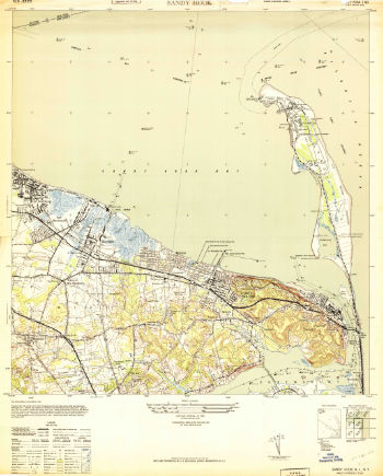
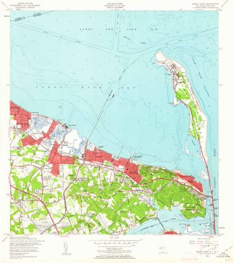 1954 Topographic Map "Sandy Hook" From USGS Store |


